huberww
Forum Replies Created
-
AuthorPosts
-
huberww
Participant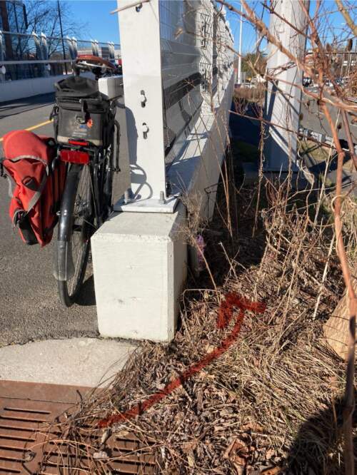 Participant
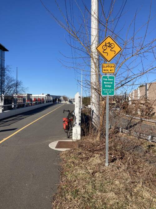 Participant
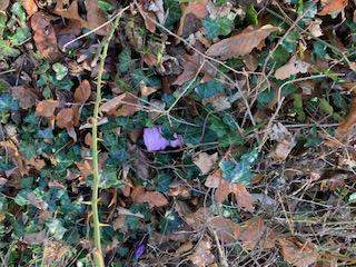
Now relocated to a more heavily trafficked location, the east end of the so-called Pete Beers Memorial Bridge. Get out in the sunny weather and grab the pink Calvinball stashed just to the right of the end of the span.
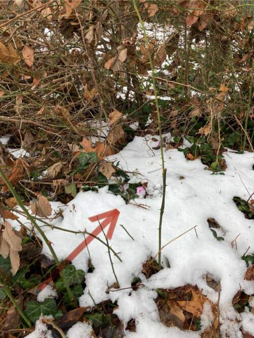
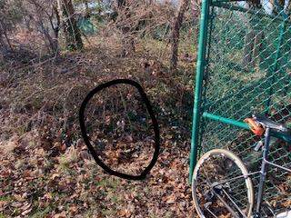
ParticipantAs if 10am, #cb1/Spokes remained atop Minor’s Hill in Arlington in the melting snow just a few steps from the Williamsburg Blvd entrance to the park.
 Participant
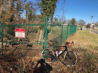
Astride the former NW boundary of the District atop a hill that is Not Major, #cb1/Spokes may now be found in another former Civil War camp and observation tower site.

 Participant
Sure is hard for me to see how these new gates can be characterized as a “pilot” when seemingly-effective gates that were less obstructive to bicyclists were in place for years.
ParticipantRiders on the CCT now have to navigate a more constricted pass-through at the end of the trail (west end of Water Street in Georgetown, under the old aqueduct). New gates have been installed, apparently to further restrict auto access to the Washington Canoe Club. As you can see, bikers now have to use the narrow passage along the wall of the archway (left side of pic, headed outbound). You will have to weave to avoid parked cars and maybe stopped bicyclists. A terrible design for bike traffic with poor sightlines. Formerly, bikes could pass without having to slow too much through the center of the gates where the chain now exists, and you could see oncoming traffic much better. The new configuration would not allow a biker to pass through the middle of (between) the gates, as in the past, even if the chain was not there.
No idea what may have been wrong with the old gates.
WTF, NPS?!!?
[ATTACH=CONFIG]30822[/ATTACH]
ParticipantNote on your green BTWD 2023 T-shirt: I was unable to get the XL I had requested so I took a 2XL that was offered. The kind staffer distributing them mentioned that the shirts were running small this year. I just ran mine through the wash and it shrank dramatically, so much that it won’t fit me (whereas an XL has always fit in the past — granted I’ve put on a few extra # over the winter months). So you might wash yours in cold water and/or avoid the dryer.
ParticipantTraversing Arlington westbound on the Wilson Boulevard and Fairfax bikelanes through Clarendon and Ballston continues to be horrendously affected by construction. I highly recommend the pleasant Key Boulevard parallel route. Key has recently been repaved and is smooth as a baby’s bottom. Wilson and Fairfax not so much.
ParticipantSeminary Road improvements are cited in this WaPo letter to the editor as a strong safety model. This letter responds to an earlier letter that opposed bike lanes on Old Georgetown Road in Bethesda (and which had also engaged in victim blaming).
https://www.washingtonpost.com/opinions/2022/11/25/bike-lanes-are-necessary-make-everyone-safer/
ParticipantUtility work closes off the switchback at the top of the 41st Street hill bike path (above Chain Bridge, access to Glebe Road). The bike path remains passable, but you just cannot use the switchback portion and now have to go straight through where the gate usually closes off that passage. This will be tougher than usual to ride up and will test your braking power headed downhill. When leaves start dropping, traction may be lacking. Careful, folks!
It is not clear how long this condition might last. I’d guess that they are relining pipes so this may take a few weeks?
ParticipantThis sign caught my eye as I was wrapping up a fine ride on the W&OD this afternoon …
[ATTACH=CONFIG]29137[/ATTACH]
August 23, 2021 at 5:29 pm in reply to: North Glebe Road at Chain Bridge Closed 9 Days (or so) on August 13 at 10 PM #1114602ParticipantWork remains ongoing as of this morning, and bridge remains closed to cars. The construction crews are more than happy to wave bikers across the bridge, though I was asked to walk my bike across yesterday. Added bonus is that you can ride up Glebe Road, rather than 41st, without any traffic while the construction continues to restrict cars.
Once across the Pimmit Run bridge, however, you must be even more careful than usual because there are no traffic signals to slow or otherwise modulate the cars and trucks whizzing through the sharp turn onto/off of Chain Bridge.
Photo from Sunday, 9/22, looking across new span toward Chain Bridge. Not pictured: the new bike lane obscured behind orange forklift on the left.
[ATTACH=CONFIG]25360[/ATTACH]
August 11, 2021 at 12:01 pm in reply to: North Glebe Road at Chain Bridge Closed 9 Days (or so) on August 13 at 10 PM #1114554ParticipantBut with enough speed coming down the 41st Street hill and with a little kicker ramp at the bottom, you could clear the bridge-less gap (especially on one of those carbon Salsa Warbirds), no?
") Participant
ParticipantThis wormhole is a half-mile long set of tunnels and bridges that carry you smoothly over the Dulles Toll Road. Access this wormhole from the sidewalk on the westbound side of Route 7 at Tyco Road (near Spring Hill Metro Station), pass the last of the car dealerships and ascend the first bridge. This winds around and eventually drops you out … on the muddy shoulder of Route 7 about half a mile short of the Lewinsville Road intersection. This fine bike infrastructure is worth the trip. But for those of you sporting fenders, beware of any vines extending out into the path which may grab your fender and cause an unplanned stop (as happened to me). Thanks to rcannon for showing me this one.
[ATTACH=CONFIG]24589[/ATTACH]
[ATTACH=CONFIG]24590[/ATTACH]
[ATTACH=CONFIG]24591[/ATTACH]
[ATTACH=CONFIG]24592[/ATTACH]Site of future trail extension?
[ATTACH=CONFIG]24593[/ATTACH] -
AuthorPosts