Pentagon "desire path"
Our Community › Forums › General Discussion › Pentagon "desire path"
- This topic has 44 replies, 20 voices, and was last updated 1 year, 10 months ago by
 Judd.
Judd.
-
CreatorTopic
-
July 6, 2013 at 4:37 pm #913688
 lordofthemarkParticipant
So in a fit of exploration, I attempted to ride up the “desire path” or “scofflaw trail” that connects the end of the side trail from the MVT just south of the humpback bridge, to Boundary Channel Drive by the Pentagon parking lot.
It was a few inches wide (I was worried about poison ivy from the encroaching vegetation – maybe this is better in winter?) relatively steep grade in parts, and sloped off to the right. I ended up walking my bike for most of it, and only got back on for the “good” part, the ride on the grass along Boundary Channel.
A. Who uses this? Mountain bikers looking for a quick adventure?
B. What is the point of the stub end paved trail? Was there at one point a plan to extend that to Boundary Channel? Is there still?
-
CreatorTopic
-
AuthorReplies
-
July 6, 2013 at 10:40 pm #974718
PotomacCyclist
ParticipantI don’t know who uses it. I didn’t think anyone really used that path, but maybe a few hardy souls do.
I guess the stub trail was added because it was easier to build in conjunction with the MVT improvements at and near the Humpback Bridge, when all of that was rebuilt and improved a couple years ago. Arlington has long wanted to extend that trail from the Humpback Bridge, along the Pentagon Lagoon and over to Boundary Channel Drive. The DOD has denied requests to allow the trail to be extended, for vague security reasons. There’s a small structure next to the lagoon, but a trail could easily be built outside of the fence.
The security argument doesn’t seem convincing to me. The security isn’t tight in that area. Anyone can just as easily drive, ride or walk on Boundary Channel Drive, next to the small building. The fence isn’t that high either. If the building were so vital, then why doesn’t the Pentagon have better security for it? It’s also pretty easy for someone in a small boat from the marina to ride right up to that building. I don’t know what the building houses.
Anyway, I think Arlington convinced the powers that be (FHWA, NPS?) to build that stub, or they may have done it themselves, as a hint to the DOD that there is demand for the trail extension. It’s up to DOD whether or not the trail is ever completed. Arlington still wants to complete the trail, but they haven’t received DOD permission to proceed yet.
July 7, 2013 at 3:40 am #974724KLizotte
ParticipantI presume you have taken the other trail that goes under Humpback Bridge to Columbia Island and taken the bridge over to Boundary Drive? It’s a little longer than the desire path but at least it is all paved and legal.
July 7, 2013 at 4:16 am #974726 chris_sParticipant
There is some hope that the Boundary Channel Drive Interchange project will get the trail far enough away from the Pentagon that they’ll allow it. We’ll see.
July 8, 2013 at 2:27 pm #974785dasgeh
ParticipantWhen Arlington negotiates with DoD (e.g. re: ANC and Columbia Pike near 395), do they bring up all of these issues? Or is there at least a strategy beyond asking, one off, “please, we’d like this little thing”? There are a number of issues that impact cyclists (I’m thinking this, bike access to Fort Myer, bike access to ANC, I’m sure there are others) that I’d hope could be solved with a more coherent strategy.
July 8, 2013 at 10:29 pm #974860PotomacCyclist
ParticipantThe relationship seems strained at the moment, with the on-again/off-again deal for the land swap at Columbia Pike/Southgate Road/Navy Annex. The two sides announced an agreement, or an agreement to have an agreement, but then it fell apart.
I would think that Arlington brings up issues more than once, but I don’t know how often they meet with DOD.
July 9, 2013 at 2:00 am #974869Bilsko
ParticipantCan somebody map this on google maps for me – I’m struggling to figure out just where this trail is.
I’m working on my route selection from DC to crystal city and the regular MVT–>LBJ grove–>Columbia Isl. Marina Bridge–>Boundary Channel Dr–>Long Bridge Dr–>Crystal City route is fine, but the LBJ grove detour is a bit out of the way and the current state of Long Bridge Dr. is AWFUL (although it looks like it will be repaved within the next few weeks)July 9, 2013 at 2:09 am #974870dbb
ParticipantHere you go
If you take the downstream tunnel under the Humpback Bridge, you will be on a trail between the lagoon and I395 until the trail ends. I posted some pics a while back and I’ll post that link if I successfully locate them
July 9, 2013 at 2:09 am #974871PotomacCyclist
ParticipantJuly 9, 2013 at 2:26 am #974873dbb
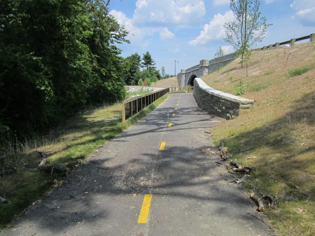
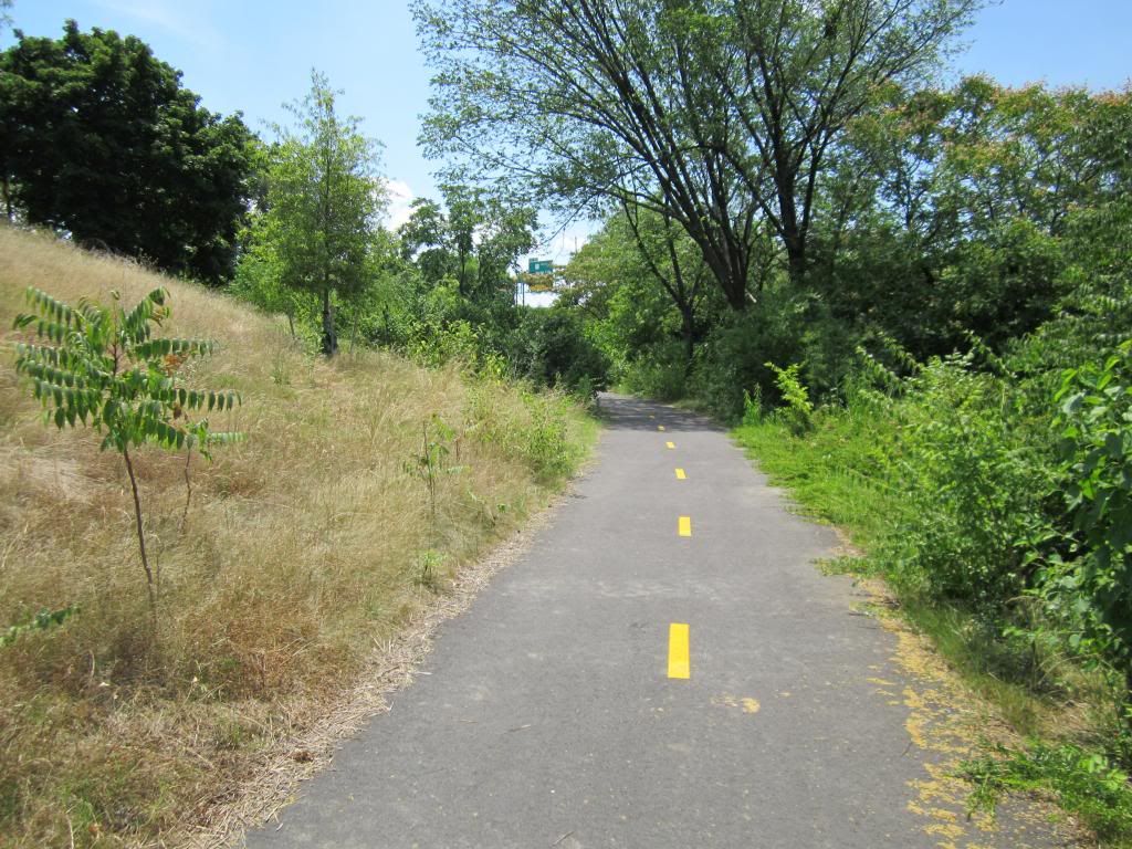
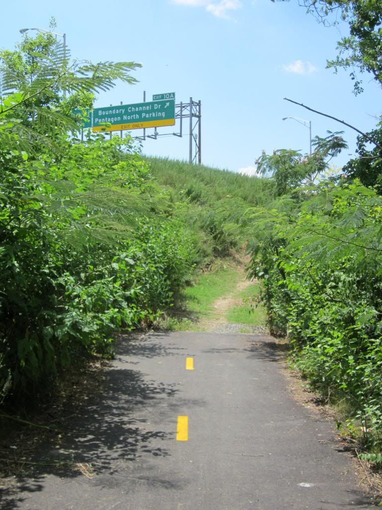
ParticipantHere are some photos. They were taken in June 2012
You can see the tunnel under the Humpback
The trail continues parallel to I395. You can see the interstate signs in the photo below
And then it just dies.
The little building on the south side of the lagoon (you would encounter it if you continued on the desire path) has a number of signs suggesting it is a secured building and discouraging photography
July 9, 2013 at 5:15 am #974876PotomacCyclist
ParticipantThere are plenty of pictures of the building on Google Maps – Street View. You can also see how poor the security is there. Anyone can walk right up to the fence, which doesn’t appear to be electrified. It would take minimal effort for anyone to climb over the fence, which is why I’m puzzled about DOD’s resistance to allowing a bike trail there.
July 9, 2013 at 1:33 pm #974892 lordofthemarkParticipant
@PotomacCyclist 57262 wrote:
I don’t know if I’d recommend riding through there.
I would not recommend it. DBB’s last photo shows the GOOD part of the desire path.
July 9, 2013 at 2:41 pm #974904jopamora
ParticipantYou could go via Pentagon parking area and Army Navy Drive to avoid going under I-495 and Long Bridge Dr.
July 10, 2013 at 1:38 am #974998Bilsko
ParticipantI am SO getting arrested tomorrow.
July 10, 2013 at 12:35 pm #975017Bilsko
Participant@Bilsko 57404 wrote:
I am SO getting arrested tomorrow.
Strava: http://app.strava.com/activities/66057386
Ride report:
The trail is pretty easy to pass through – I was on my Surly with 28s and only had to walk a small section because the overgrowth was blocking my view of the trail and I didn’t want to risk hitting anything.
Its nice that some generous soul has placed wooden slats over two holes along the trail -nice sturdy wood that I rolled right over.
Going from the MVT towards the Pentagon was pretty easy – I think the climbing would be a bit trickier going the other way.
There was a white SUV parked inside the fence at the boathouse by the pentagon and I heard someone using a Weedwhacker but didn’t see them. The SUV looked all Pentagon-policey so I just kept rolling through.
Hopped the curb down onto the freeway off-ramp. I must have been a sight for those drivers who came around the bend and saw me rolling down the offramp.Its not terribly convenient – even less so if you’re heading towards the MVT from the Pentagon – so I’m not sure how much I’ll bother using it. Still, its nice to have route options
June 5, 2015 at 6:12 pm #1031476PotomacCyclist
ParticipantBoundary Channel Drive Interchange Project
Public Information MeetingDate/Time
Date(s) – 06/23/2015
6:30 pmLocation
Aurora Hills Community & Senior CenterContact Details
Bonnie Parker
703-228-3173“The Boundary Channel Drive Interchange Project will replace the existing interchange with Interstate 395 in order to improve traffic operations and safety for all road users. A new connection to the Mount Vernon Trail will also be completed as part of the project for trail users to access Long Bridge Drive, the Pentagon and Crystal City.
All members of the Arlington community, including commuters and transit riders, are invited to attend and provide input on interchange design alternatives.
Participants also will learn about transportation projects underway in the Crystal City-Pentagon City area, and planning for future transit service in Arlington.”
-
AuthorReplies
- You must be logged in to reply to this topic.


