Good News on Infrastructure thread
- This topic has 606 replies, 83 voices, and was last updated 7 months, 3 weeks ago by
 .
.
-
Topic
-
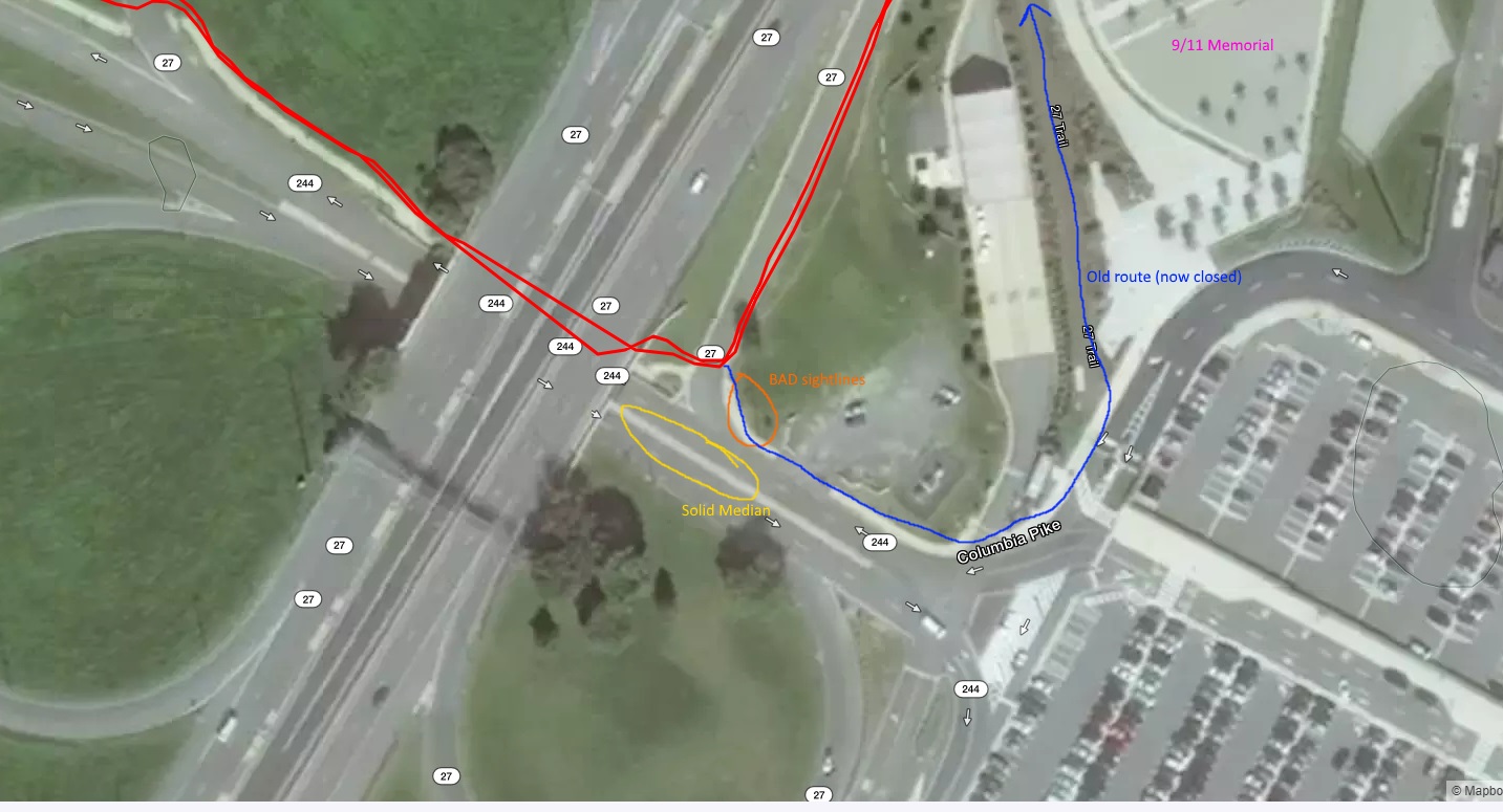
I would like to start this as a list of all new infra (or major rehabs) that support cycling in the area – bike lanes, cycle tracks, MUT’s, bike boulevards, wide lanes, etc, etc. Across all jurisdictions in the metro area. For now I will start with links to existing threads – many such already exist in the road and trail conditions forum, and in the forums on Arlington, Alexandria, and FABB. I envision it as sort of a grand list of “good” news.
I think it should probably be limited to things actually under construction, completed, or at least definitely planned and funded, as opposed to things still up for debate, or general jurisdiction wide plans.
Eye Street (with its bike lanes) being repaved from SW to SE.
http://bikearlingtonforum.com/showthread.php?5975-Eye-Street-SW-bike-lanes
Columbia Pike Bike boulevard plans, and discussion of trail cross golf course
http://bikearlingtonforum.com/showthread.php?5926-Columbia-Pike-bike-boulevard-plan-update
Chambliss Street trail bridge in Alexandria complete
http://bikearlingtonforum.com/showthread.php?5603-Chambliss-Street-Bridge-Nearly-Complete


- You must be logged in to reply to this topic.