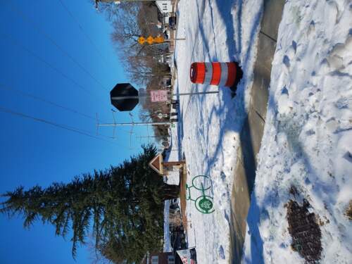
Jan 2025 – road/trail conditions – what trails get salted?
Our Community › Forums › Road and Trail Conditions › Jan 2025 – road/trail conditions – what trails get salted?
- This topic has 26 replies, 15 voices, and was last updated 5 months, 1 week ago by
Rootchopper.
-
CreatorTopic
-
January 3, 2025 at 3:50 pm #1135498
 veleau_monicaParticipant
Starting a thread as I stare out the window at the Vienna ThunderSnow and dread my 12 mile bike ride home (with a broken toe) to Georgetown from dog sitting/for freezing saddles.
-
CreatorTopic
-
AuthorReplies
-
January 7, 2025 at 2:37 pm #1135670
DrP
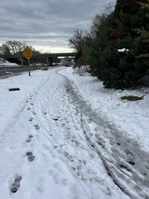
ParticipantIn Arlington, many of the trails get their brine treatment. The bigger question, especially now, is which ones have been plowed to date. And bike lanes.
Anyone know the state of any trails? I am hoping to bike to the office tomorrow.
The Arlington traffic cameras show a few areas and many of the unprotected lanes look to be where the snow was pushed to for the car lanes. The protected lane on Fairfax just before 66 looks to be snow covered. Some of the Columbia Pike sidewalks look clear and others not at all.
[I presume Custis has been plowed, although the snowpack-to-ice-to-pavement numbers are always iffy and dependent on when they plowed versus people started using the trail]
January 8, 2025 at 8:50 am #1135700huskerdont
ParticipantI’m bike commuting from Arlington into DC on Thursdays, but live in Richmond now so can’t assess the trail conditions from here. If anyone could update/respond to DrP, esp. re: Custis, that would be great, but I realize they’ve pretty much killed this forum so it may not happen. If needed I’ll use the roads, like in the olden times.
DE
January 8, 2025 at 9:47 am #1135702Participant[yes, I have noticed the effective death of this forum except for freezing saddle pictures. Very sad]
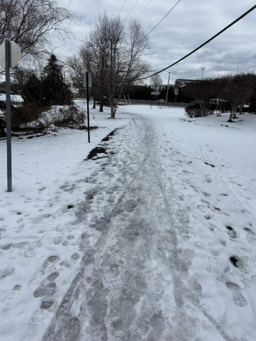
Custis is clear* to tarmac from at least St Ann’s church to East Falls Church. Accesses are not typically clear.
W&OD is clear* to tarmac from Custis to Columbia Pike. South of the Pike has been plowed, but there are a lot of frozen tracks/slush such that in the morning it can be difficult to ride on for long periods. Between Walter Reed and the end of the W&OD it is solid pack and I took the road.
[The bit of Bluemont trail I could see was cleared, although I can see the melt that crosses the W&OD beginning to build up. Also, 4MRT from Wilson to just under Carlin Springs road looked plowed, but not 100% clear, as I glimpsed from W&OD]
4MRT is clear* to concrete/tarmac from Shirlington to Eads (the wooden bridge by the power plan looked like it wasn’t cleared so no clue beyond that).
Eads protected bike lanes were cleared, but every driveway has snow from the related parking lot, so those are all impassible and I took the road. 18th street to Hayes was the same.
*clear = clear to the trail surface for the majority of the width of the trail. There are bits where the trail narrows. There are occasional bits that have frozen melt or weren’t quite clear, but they are few and short.
January 9, 2025 at 4:56 pm #1135750veleau_monicaParticipantsometimes reddit /bikedc has good updates 🙁
January 10, 2025 at 11:23 am #1135773Participant[But this used to be a great source, then they changed (updated?) the forum and it all became harder to use, so now it seems no one does. ]
Ballston connector from Custis to nearly Fairfax Drive is clear – it is actually clear around the Ballston Pond Park. Then there is about 10ft of solid snow/ice until the walkway is cleared by the building. Then the protected 2-way bike lane is unplowed.
In Ballston, the protected lanes on Quincy are not plowed. The unprotected lanes on Fairfax drive are hit or miss, so taking the road is safer since you can suddenly come upon a giant blockage. Many sidewalks are clear, but oddly not the one in front of the Holiday Inn. The driveway is clear, so you can take that to get to the Bluemont trail, which is clear.
Intersections are hit or miss – some clear, some have a way to walk a bike over it, and others are just a mess.
The W&OD between Columbia Pike and Walter Reed is much improved since Wednesday as parts melted. A few bad spots, but generally good. From Walter Reed to the end is still a lot of hard pack. The road works as does turning on Walter Reed (or Shirlington Road, depending on your direction) towards S. Arlington Mill Dr – the path along 4MR is clear.
January 13, 2025 at 1:04 pm #1135897 Mike RParticipant
As of 13 Jan, noon-ish, WOD east and west of Cedar is all ice and slush
January 13, 2025 at 10:02 pm #1135915obscurerichard
ParticipantQuincy from the W&OD trail to Glebe has almost entirely cleared bike lanes now!
The W&OD has some icy patches in Shirlington close to the trail head but is otherwise clear to the Custis trail. Custis is clear from the W&OD to Quincy.
January 14, 2025 at 1:00 pm #1135935ParticipantIn Arlington:
4MR Trail south (east?) of Eads looks like it could be clear, at least I could see that the temporary boardwalk was cleared.
The protected lanes are Eads are nearly clear (aside from some frozen melt) and only one or two places require possible stopping to walk bike over snow piles. Similar for 18th st to Hayes.
Anyone know if the trail along Washington Blvd from Towers Park to Rt 50 (Lyon Park area) is clear or at least mostly passable? And the off-street trails in Lyon Park?
January 14, 2025 at 8:08 pm #1135959CaseyKane50
ParticipantYesterday, the Washington Boulevard Trail was ice from route 50 east towards Columbia Pike. I suspect there was some melting today. I skipped the Lyon Park Trail and took the service road up to North Filmore.
 January 15, 2025 at 12:34 pm #1135992
 Frump McgooParticipant
Any idea how of the trail conditions of the W&OD going west from Sterling to Purcellville? If I was betting – I bet that the W&OD is all covered in frozen compacted snow at the moment. But that is total conjecture based on the general condition of the snow I’m seeing right now outside. Wednesday 1/15/25 at 12:30 PM. Would love to do a ride this coming Friday, but I have a feeling the trail might not be safe to bike on then. Thanks for information.
January 15, 2025 at 12:36 pm #1135993ParticipantThank you! That was very helpful. I chose to take North Filmore to Rt 50 after spotting that the trails in Lyon Park looked bad. Then took the service road down to Washington Blvd. I jumped on the sidewalk there. The sidewalk wasn’t too horrible, but I needed to put my foot down many times. I could see the trail from the sidewalk and chose to take S Courthouse to Columbia Pike, which was clear. At Columbia Pike on got on the sidewalk and headed east. The sidewalk was in good shape (some curb cuts were bad, but it was generally good). The sidewalks from around Washington Blvd to Joyce were clear (although I took the road from Orme to Joyce). Joyce looked low in snow but high in mud.
January 21, 2025 at 4:07 pm #1136274ParticipantWell, Sunday’s precipitation mix along with the temperatures have set a few places back, I fear. The Custis and W&OD in the Westover area looked clear of snow, but icy patches exist with some of the frozen melt (and some entrances have gotten bad).
No idea how the W&OD south of Columbia Pike is or 4MRT south of Shirlington is (presume as the others, some icy patches).
I tried to peer at the Washington Blvd trail from Rt 50 to Tower’s Park and that still looked bad (although covered in white so some of the frozen ruts/footprints were not as obvious.
Anyone been on these or other trails?
January 22, 2025 at 1:43 pm #1136318Rob Lowe
ParticipantCap Crescent Trail (Bethesda Area Down to DC) –
- MD Portion is 95% good from Little Falls Pkwy down to DC line with a few spots where melt-off crossing trail was frozen into ice across/on edge spot of trail.
- DC Line to GTown is mix of compacted ice/crunchsnow and some clear areas/spots.
- Studs were nice for sure! No slippy slidey.
Foggy Bottom Area – H and I Street between say New Hampshire and 20th – Not bad though some gutter areas are still really nasty, but it’s dc.
January 22, 2025 at 1:47 pm #1136319peremaya
ParticipantI went on a recon ride at lunch time and this are the conditions I found:
W&OD Trail is clear between the Trail Head in Shirlington to Benjamin Banneker Park.
Except for a couple of spots where you find “ice minefields” in shady spots and at the end of the trail just before exiting Benjamin Banneker Park.

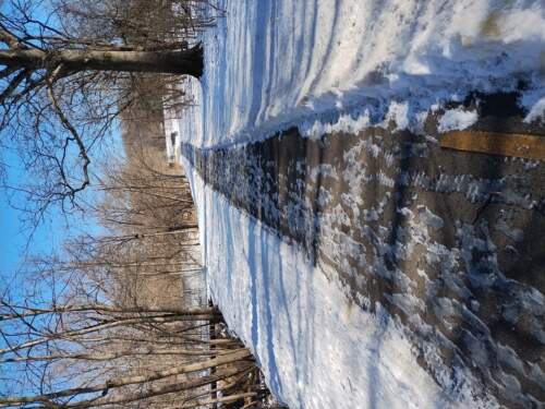
The falls church portion of the trail has not been cleared and is a mix of ice and frozen snow. The next pictures were taken from “Little Falls St” first one looking north on the W&OD the second one looking south towards the bridge over Langston Blvd.
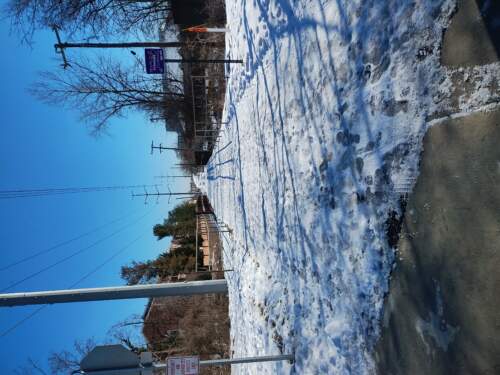
Link to strava ride with map of picture locations: https://www.strava.com/activities/13424718735
January 23, 2025 at 10:32 am #1136345 ShawnoftheDreadParticipant
The Custis is clear with the exception of some clear ice on the east end of the Spout Run bridge. Better riders will probably just ride right over it; I flintstoned it for about 10 feet.
The downstream path of the Key Bridge is also clear, with a narrow clear path on the brick sidewalk at the Georgetown end.
-
AuthorReplies
- You must be logged in to reply to this topic.