Fairlington124
Forum Replies Created
-
AuthorPosts
-
Fairlington124
ParticipantThe project page exists, you just have to hack around with the URL a bit:
https://alexandriava.gov/localmotion/info/default.aspx?id=88173
The extent is exactly as I thought; Braddock to King
ParticipantPlans have been posted to Alexandria’s LocalMotion webpage:
Looks like some basic intersection improvements along the way. Unfortunately the project doesn’t include widening the path between Alfred and Patrick, which is the narrowest part of the bikeway. Iideally they’d match the width of the path between Alfred and Columbus.
https://www.google.com/maps/@38.8007121,-77.049054,247m/data=!3m1!1e3
Participant@lordofthemark 127640 wrote:
I am pleased to report that the Traffic and Parking Board has approved no right on red at Commonwealth and Braddock. Alexandria moves ahead, even if in this instance only after someone was killed.
In December the Traffic and Parking Board will meet to consider reducing the speed limit to 25 mph on Seminary east of 395, and on Quaker from King to Duke. The former with the support of the City, the latter without, though that is a question of some controversy, IIUC.
Now the goal needs to ban right-on-red (with no exceptions) at the following types of intersections:
-Speed limit above 25 MPH for the street being turned onto.
-Blind turn or limited visibility turn
-Adjacent to, or within, residential neighborhoods
-High-volume pedestrian intersections
-Within .25 or .5 miles of Metro stationsI was hit on an illegal right-on-red back in the Spring of this year. It was a “No right on right (When pedestrians are present)” signed intersection. People don’t notice or care about the “When pedestrians are present” condition, so ban it outright.
If all of these criteria result in the majority of the City being non right-on-red then so much the better.
Participant@lordofthemark 127246 wrote:
I do not know the status of the King/Beauregard project – it is apparently still on the T&ES website as starting in calendar year 2015, but I see no signs of that, and I have not been to a BPAC meeting in a while. Do you have other info?
Deleted from the LocalMotion webpage (Hillary Poole’s program), but remains on the TES page. The website said beginning in the Fall of this year, but I haven’t seen a gram of dirt overturned yet. Going by the project description, I assume that Phase I will be the installation of the medians, and that Phase II will be the widened sidepaths (since “Utility Relocation” falls between Phase I and Phase II).
On a related note, a public notice is on the old hospital site at 4600 King, where the new development with Harris Teeter may go. Many people will walk there, from Park Center, Fairlington, etc. City better plan ahead for this.
ParticipantSo the City fails to put any counters on the West End, save for one on Holmes Run Trail.
Thus there are no statistics on ped and bike activity in the West End.
Thus they have a ready-made excuse for the continued neglect of the West End.
Brilliant.
How about they put a counter on the King Street/395 bridge, where people still use that sidewalk despite its horrific condition and its lack of proper crosswalks on either end of the bridge. Or maybe at King+28th where I got hit by an illegal right-on-red. Or King-Quaker-Braddock where people make illegal right-on-red on a daily basis.
ParticipantIt appears as if the Potomac Yard Trail may be extended along the east (train tack) side of Potomac Avenue. If the most recent Google Maps photo (https://goo.gl/maps/WM2jpb6obSv) is indicative of anything, it looks like it will be about 475 feet, or about as far north as the southern end of Target. I took some photos which you can interpret how you like, but it seems that they are extending the trail, based on the width of the concrete in Photo 1. I saw no posted project details. I wonder if the PY Master Plan alludes to the trail.
[ATTACH=CONFIG]9974[/ATTACH]
[ATTACH=CONFIG]9975[/ATTACH]
Photo 2 suggests some sort of foot path leading towards terraced seating near the retention pond.
Participant@chris_s 120320 wrote:
Seattle being the exception apparently. Anyone know how they did it?
[ATTACH=CONFIG]9117[/ATTACH]
Simple – instead of building a sea of parking lots, they didn’t build a sea of parking lots! :p
Seriously though, the area around the stadium looks pretty constrained (ports to the west of it/railyards all around/there it is, stuck in the middle of there).
Evidently there is short supply, based on prevailing prices (and demand, they’re pretty successful) – http://ftw.usatoday.com/2014/09/it-cost-seahawks-fans-140-to-park-near-centurylink-field
Based on this fan website (http://reppinthe12.com/2013/09/14/tailgating-lots-for-seahawks-games/), people simply adapt. It advocates “bar-gating” (i.e. going to a bar, what a novel concept), and it also seems like that the tailgating is largely dispersed south of the stadium. Presumably many of those industrial areas are less busy on Sunday afternoons, so there isn’t as much competition for space as during a business day.
It goes to show that people will adapt better than you give them credit for.
It also helps that they have public transit at the stadium…
ParticipantGiven that Potomac Green accommodates two-way traffic, you could argue that it’s effectively two 8.5-foot lanes
Participant@mstone 117678 wrote:
The biggest difference is that the Dutch don’t run them right next to parked cars.
[ATTACH=CONFIG]8827[/ATTACH]
ParticipantFBI in Springfield would be at the GSA warehouse location, which is very close to the Franconia-Springfield Metro. The soon-to-open “joe alexander road” would make for about a .45 walk (10 minutes) from the Metro to the warehouse proper.
If they invested in a direct mixed-use path, the same trip would be about .3 miles, about 8 minutes walking.
Can’t speak for the other sites because I’m not familiar.
The sort of people who would Metro to FBI in the first place would probably be okay with a short walk. I think that the walk would only be a hindrance to people who would normally drive anyway. But I presume there would be a shuttle.
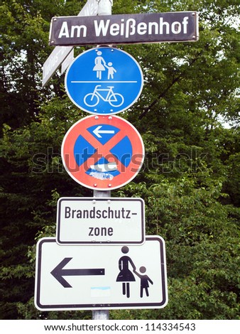
ParticipantFirst post here (woo!). I use that stretch quite a bit. Never seen motorized vehicles but I could believe that some use it.
Why not some graphic commands, like this “pedestrian and bike” sign I would see a ton of in Germany? http://image.shutterstock.com/display_pic_with_logo/97684/114334543/stock-photo-a-road-sign-for-a-pedestrian-zone-bike-lane-and-no-parking-114334543.jpg
Are there any such signs in the US lexicon of road and path signage?
-
AuthorPosts