Mystery Sign
Our Community › Forums › Road and Trail Conditions › Mystery Sign
- This topic has 30 replies, 14 voices, and was last updated 7 years, 4 months ago by
 Steve O.
-
CreatorTopic
-
May 23, 2017 at 1:59 am #919424
ginacico
ParticipantWhat’s the Anderson Trail? Seen on Army Navy Drive at the corner of Joyce, looking uphill.
[ATTACH=CONFIG]14841[/ATTACH]
-
CreatorTopic
-
AuthorReplies
-
May 23, 2017 at 8:22 pm #1071217
 lordofthemarkParticipant
@Steve O 160510 wrote:
I’m mixed on this. If, in fact, the powers that be put up clear, abundant signs and maintained them, then I would be okay. In the absence of signage, then no one will know what you are talking about. Just like the Donaldson Run trail, which is officially the Zachary Taylor Trail, but there isn’t a single sign anywhere announcing that. Donaldson Run is descriptive and tells you where it is. That’s a good name, and it’s what everyone calls it already.
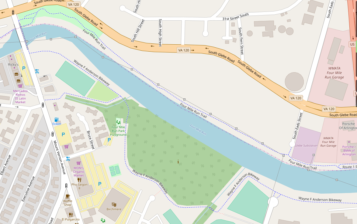
No one calls the trail in question the Anderson Bikeway as far as I have ever known.In which case I would prefer calling it something descriptive, like “Four-Mile South Side Trail,” or “Alexandria 4MR Trail” so at least people have an inkling of what you mean.
Four Mile Run Trail is, in fact, a huge problem, because it’s actually about 6 different disconnected sections of trail. Whenever it’s referenced it requires an additional descriptor, like “the section in Madison Manor,” or “the part in Barcroft.”
Do you think anyone knows what I am talking about when I refer to the Lucky Run Trail?
May 23, 2017 at 8:27 pm #1071219bobco85
Participant@lordofthemark 160513 wrote:
Do you think anyone knows what I am talking about when I refer to the Lucky Run Trail?
I do, but that’s because I added it to Google Maps (when Google Mapmaker was still around) 😎
May 23, 2017 at 8:36 pm #1071220lordofthemarkParticipant@bobco85 160515 wrote:
I do, but that’s because I added it to Google Maps (when Google Mapmaker was still around) 😎
And my wife knows it’s called that
") Also some cyclists and runners, cause Lucky Run is mentioned in a Strava segment.
Also some cyclists and runners, cause Lucky Run is mentioned in a Strava segment.Which indicates one powerful way to make people aware of the Anderson Bikeway without putting up any new signs
I will refrain from comment on the implications of calling a Multi Use Trail a “bikeway”.
May 23, 2017 at 8:41 pm #1071221lordofthemarkParticipant@bobco85 160466 wrote:
Wow, I’ve never heard of the Wayne Anderson Trail before!
After doing a bit of Google research, it appears that this section is the Wayne F Anderson Bikeway (full name): https://goo.gl/maps/qsy2LjpuMd42 (please correct me if I’m wrong)
Pages where I saw the Wayne F Anderson Bikeway referenced:
- https://www.washingtonpost.com/archive/local/1994/04/14/bicyclists-receive-a-boost/c5470e4a-6a80-4fff-a129-945335889fbe/?utm_term=.ed2fad88f50f
- https://groups.google.com/forum/#!topic/pedalers/SRDiES98IU8
- http://www.geocities.ws/dccues/great_falls_beyondhtml.html
- http://www.rundc.com/Doc/VA/Alexandria/Dangerfield.htm
- https://www.alexandriava.gov/uploadedFiles/localmotion/info/BikePed%20Meeting%20notes%20011110.pdf
Does anyone know why the name was dropped from common usage?
Your Alexandria meeting minutes from 2010 includes discussion of the King and Beauregard intersection !! And the proposed bike/ped bridge connecting Commonwealth to Eads !!!!
May 23, 2017 at 8:58 pm #1071225CaseyKane50
Participant@lordofthemark 160517 wrote:
Your Alexandria meeting minutes from 2010 includes discussion of the King and Beauregard intersection !! And the proposed bike/ped bridge connecting Commonwealth to Eads !!!!
Ironically, the January 2010 meeting also included a brief presentation on wayfinding (see page 24 and 25).
[ATTACH=CONFIG]14848[/ATTACH]
May 23, 2017 at 9:26 pm #1071226 JuddParticipant
@CaseyKane50 160521 wrote:
Ironically, the January 2010 meeting also included a brief presentation on wayfinding (see page 24 and 25).
[ATTACH=CONFIG]14848[/ATTACH]
Those are pretty signs and I’d take them, but still too small for wayfinding for a moving cyclist.
May 23, 2017 at 9:39 pm #1071228Participant@Judd 160522 wrote:
Those are pretty signs and I’d take them, but still too small for wayfinding for a moving cyclist.
A “bike tourer” slows down to read the signs.
May 23, 2017 at 10:53 pm #1071236mstone
Participant@Judd 160522 wrote:
Those are pretty signs and I’d take them, but still too small for wayfinding for a moving cyclist.
And this is why carbon rim brakes are bad!
May 24, 2017 at 12:28 am #1071242JuddParticipant@CaseyKane50 160524 wrote:
A “bike tourer” slows down to read the signs.
Using my own strava ride titles against me…. ouch!
Truthfully, I’m not what I consider to be fast on the trails. I’m usually cruising along at 14 to 15 if there’s no trail traffic. I think the ART has the best signs in the area and they’re hard for me to read in passing. In the case of the ART, there are lots of really awesome things that those signs are pointing to that I would have likely checked out earlier if there was a larger sign as I passed.
I think a good example of sign size is the Virginia Capital Trail:
Sign with trail instructions
Mile Marker SignJune 2, 2017 at 4:03 am #1071643JuddParticipantThere is now a Wayne F Anderson Strava Segment going westbound.
June 2, 2017 at 9:23 pm #1071687JuddParticipant@Judd 160974 wrote:
There is now a Wayne F Anderson Strava Segment going westbound.
For those curious, here is the segment: https://www.strava.com/segments/15044161
This segment is heading westbound. Unless someone beats me to it, I’ll look through my rides to find one that captures going eastbound and create a segment too.
September 29, 2017 at 12:58 pm #1076263 chris_sParticipant
*whistles past*
 September 29, 2017 at 2:31 pm #1076272JuddParticipantApril 5, 2018 at 8:01 pm #1086411
Tim Kelley
Participant@Steve O 160510 wrote:
Just like the Donaldson Run trail, which is officially the Zachary Taylor Trail, but there isn’t a single sign anywhere announcing that.
It’s on the BA bike maps that way. And WashCycle uses it.
I think it should be discussed further!
April 6, 2018 at 2:10 pm #1086421Steve OParticipant@Tim Kelley 177197 wrote:
It’s on the BA bike maps that way.
True, and I think it was one of the dumber things BA did.
-
AuthorReplies
- You must be logged in to reply to this topic.