Hazardous Bollard and Bollard Collar Map
Our Community › Forums › Arlington Bicycle Advisory Committee › Hazardous Bollard and Bollard Collar Map
- This topic has 21 replies, 18 voices, and was last updated 12 years, 8 months ago by
bikesnick.
-
AuthorPosts
-
June 13, 2012 at 4:01 pm #942983
TwoWheelsDC
ParticipantEven more bollards going in at the Wilson Bridge, and they’re putting an anti-ram barrier up as well (just out of frame on the left). Anyone know if this will be the finalized trail routing? Seems idiotic to me…
 June 13, 2012 at 5:04 pm #942991
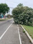 JustinWParticipant
@Mark Blacknell 22196 wrote:
I’m a big fan of whoever marks those collars with bright yellow paint.
(The parks department has been asked to remove the collars where bollards have been removed. It’s not a priority for them.)
I ran into an older gentleman a week ago spraying a bollard collar at Walter Reed and Shirlington Mill Dr. Nice guy, and he advocated participation in the Arlington Bike Avisory Committee (think that’s it) to help address the bollards issue.
Some of my faves – NOT – are along the bike trail that parallels Route 50 between Pershing Drive and 2nd Street (think that’s it). Narrow trail entrances coupled with tall old bollards = serious potential hazard. As if anyone is going to drive on that path anyway…..C’mon.
June 13, 2012 at 5:59 pm #943001consularrider
Participant@TwoWheelsDC 22201 wrote:
Even more bollards going in at the Wilson Bridge, and they’re putting an anti-ram barrier up as well (just out of frame on the left). Anyone know if this will be the finalized trail routing? Seems idiotic to me…
And they’re black! That will show up real well in low light conditions. 😡
On a positive note, from the photo it looks like they’ve re-paved the roadway and the gap between the gutter pan/curb and the asphalt is at least gone. I still haven’t figured out why they needed to create this cut out when they could have left enough room on either side of the anti-ram barrier for a bicycle, but not a car, to pass.
June 13, 2012 at 6:31 pm #943009DaveK
Participant@consularrider 22220 wrote:
And they’re black! That will show up real well in low light conditions. 😡
On a positive note, from the photo it looks like they’ve re-paved the roadway and the gap between the gutter pan/curb and the asphalt is at least gone. I still haven’t figured out why they needed to create this cut out when they could have left enough room on either side of the anti-ram barrier for a bicycle, but not a car, to pass.
Ugh. Somehow they leave plenty of room around the Capitol for cyclists to get through the barriers when they’re up, but not here.
June 13, 2012 at 7:13 pm #943013 chris_sParticipant
@consularrider 22220 wrote:
And they’re black! That will show up real well in low light conditions. 😡
Anybody know who the lead agency is on this project? Unless they’re getting reflective markings there is no way that meets AASHTO. How far apart are they?
October 2, 2012 at 11:01 pm #952692bikesnick
ParticipantCollard (painted yellow)
Entrance to Westover Park and connection to Custis Trail (N Kennebec St)
[ATTACH=CONFIG]1773[/ATTACH]Two metal bollards
S 4 Mile Run Dr at entrance to Four Mile Run Trail
[ATTACH=CONFIG]1774[/ATTACH] -
AuthorPosts
- You must be logged in to reply to this topic.